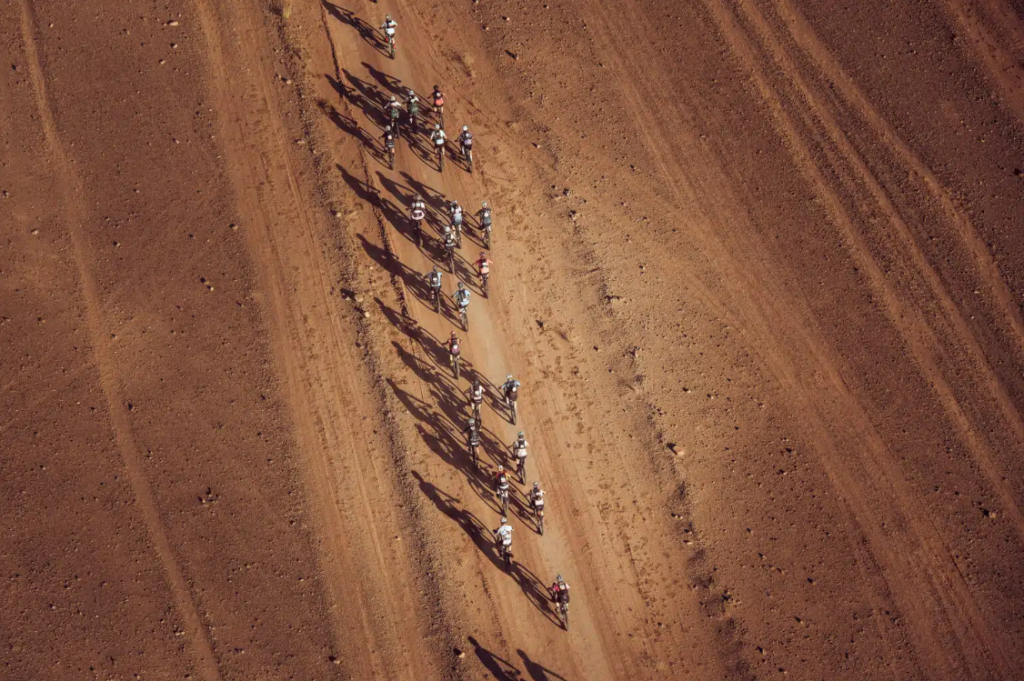
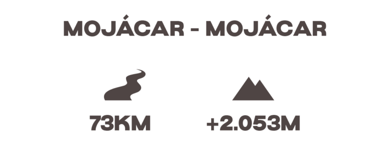
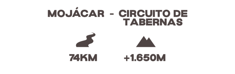
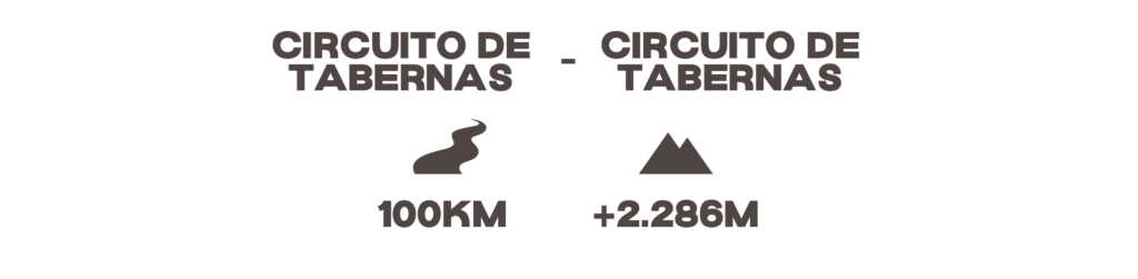
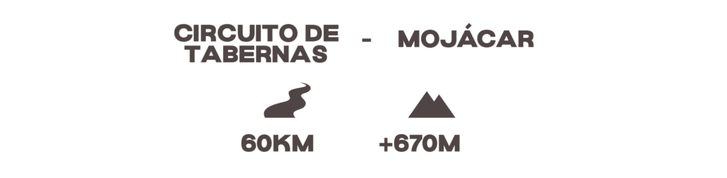
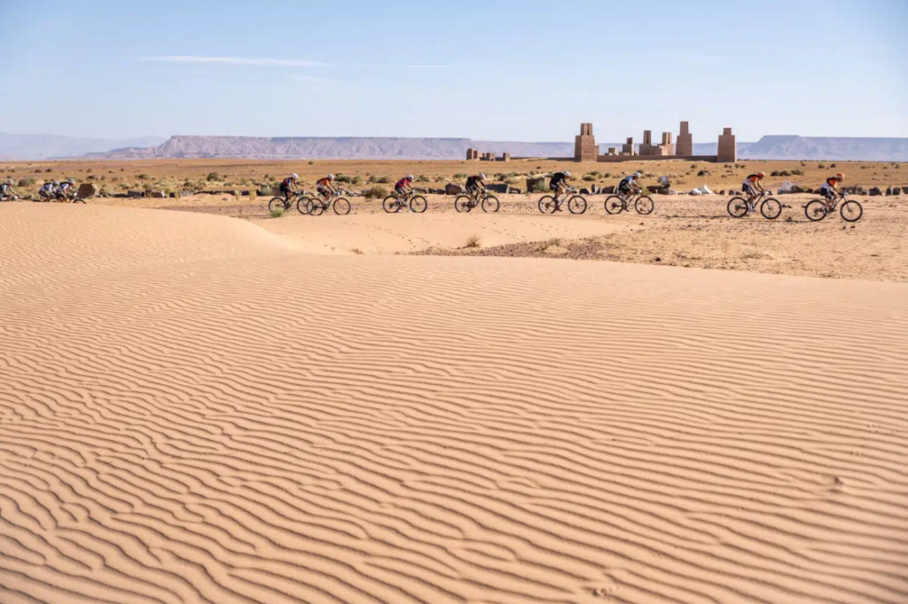
Overview

General

Four stages, over 300 kilometers, and 5,000 meters of cumulative elevation gain.

A new route that explores uncharted areas of the province of Almería and has a much stronger mountain-biking vibe. Miles of mountain trails with stunning scenery, riding along the coast, and tackling historic climbs like Velefique.

The Škoda Titan Desert Almería will announce its final route in the coming weeks, but for now, here are some preliminary details.

Route

Etapa 4 - El toyo

A loop route that begins on flat terrain and heads toward the town of Turre. There, we begin to climb through the foothills of the Sierra de Cabrera, tackling two major ascents before heading back toward the sea down a technical trail that leads us right to the Mediterranean shore. From here, the route begins on a track and then follows a trail clinging to a cliff—a spectacular stretch with the sea always to our right.

This stage begins with a fast stretch leading up to the climb toward Bedar, where, before reaching the town, we take a section of the greenway, passing through a tunnel from Los 3 Amigos Station and beginning a long climb that passes by a Buddhist temple, all within the Sierra de Cabrera.

After reaching the summit, the route follows a ridge offering spectacular views of the sea. A long, technical descent then leads down to the town of El Chive. From there, a section takes us toward the Tabernas area along well-maintained trails winding through olive groves, eventually reaching the Almería Circuit. We enter the circuit and cover the final few kilometers uphill before arriving at its paddock.

A loop stage around Almería Circuit. After setting off from the circuit itself along fast trails and riverbeds, we tackle the steep climb up to Alto de Velefique, where the Škoda Challenge will take place—a long climb with an elevation gain of nearly 1,000 meters.

From the summit, there’s still a short uphill stretch before tackling a long, rocky, and somewhat technical descent. From the valley, we take the trails that will lead us back to the starting point of the loop.

On the way back to Mojácar, we start by leaving the circuit and riding through fields of solar panels along fast trails that gradually gain elevation as we approach the town of Sorbas. After a few kilometers on paved roads, we return to the trails with a descent through a quarry that takes us to the banks of the Aguas River. From there, either along very wide trails, a short stretch of trail, or through the Rambla del Rio Aguas, we reach the seashore where the stage ends.

Highlights

Of the route

The race combines different types of terrain. Most of the tracks are in good condition. There are some sections of soft ground when crossing some dry riverbeds and some sections of trail.

Yeah. Although it maintains the main stages, the route design varies each edition to offer new experiences, improve safety, and adapt to environmental conditions.

Yes, but only when they are 100% validated. They are published two weeks before the start of the event, after the final checks and adjustments. The organization notifies participants as soon as they are available.

The race must be completed exclusively on the track. Although there may be occasional reference points for safety reasons, the regulations require following the official track with your GPS.

Yes. Each stage has official aid stations offering water and food. The exact locations are listed in the stage profile and during the daily briefing, but as a general rule, they are located less than 40 kilometers apart.

A mountain bike is ideal; we recommend a full-suspension model for greater comfort. Gravel bikes are allowed but are not ideal for this type of route.

Not in the general category. It is only allowed within the ebike program.

There may be some stages where cut-off times are established to improve the safety of participants. These will be communicated in the briefing prior to the stage.

Yeah. When a stage does not start or finish at the hotel, the organization provides official transfers.